
Walk a Duval County Street
The safest street-by-street method keeps each claim tied to its source. The Duval County Property Appraiser connects a typed location address to an RE number, legal description, current owner, owner mailing address, exemptions, sales, and a parcel map. The Clerk’s Official Records then connects book and page references to deeds. Voter information and historical directories can add evidence of occupancy, but they cannot turn ownership into proof of a whole household.
- Enter the site address in the Property Appraiser search. If it fails, remove the unit, direction, or street suffix and try a shorter form.
- Save the RE number and legal description, then open the linked map and inspect parcels in sequence.
- Compare the site address with the owner mailing address and note homestead without treating it as a resident list.
- Use Official Records book and page in Acclaim to inspect the deed and recorded ownership chain.
- Use voter records only through lawful verification or request routes, then consult reverse directories for older occupants.
This flow separates three facts that are often blurred: where land sits, who owns it, and who may have lived there. A multifamily or business-owned parcel makes that distinction even more important.
Search Duval County by Address
The Duval County Property Appraiser basic search accepts a street number, name, type, direction, unit, city, and ZIP. Fewer fields often produce better results. The official syntax permits partial patterns, including a number prefix such as 79% and a partial street such as %Stone. “Match All” is recommended once the spelling and form are sound.
| Search field | Useful entry | Street value |
|---|---|---|
| Street number | Exact or prefix wildcard | Narrows a long road |
| Street name | Base name or partial pattern | Recovers variants |
| Type, direction, unit | Optional | Can separate duplicate addresses |
| City and ZIP | Optional | Helps with repeated names |
| RE number | 123456-0000 | Returns the exact parcel |
The official property search tutorial demonstrates those retry patterns.
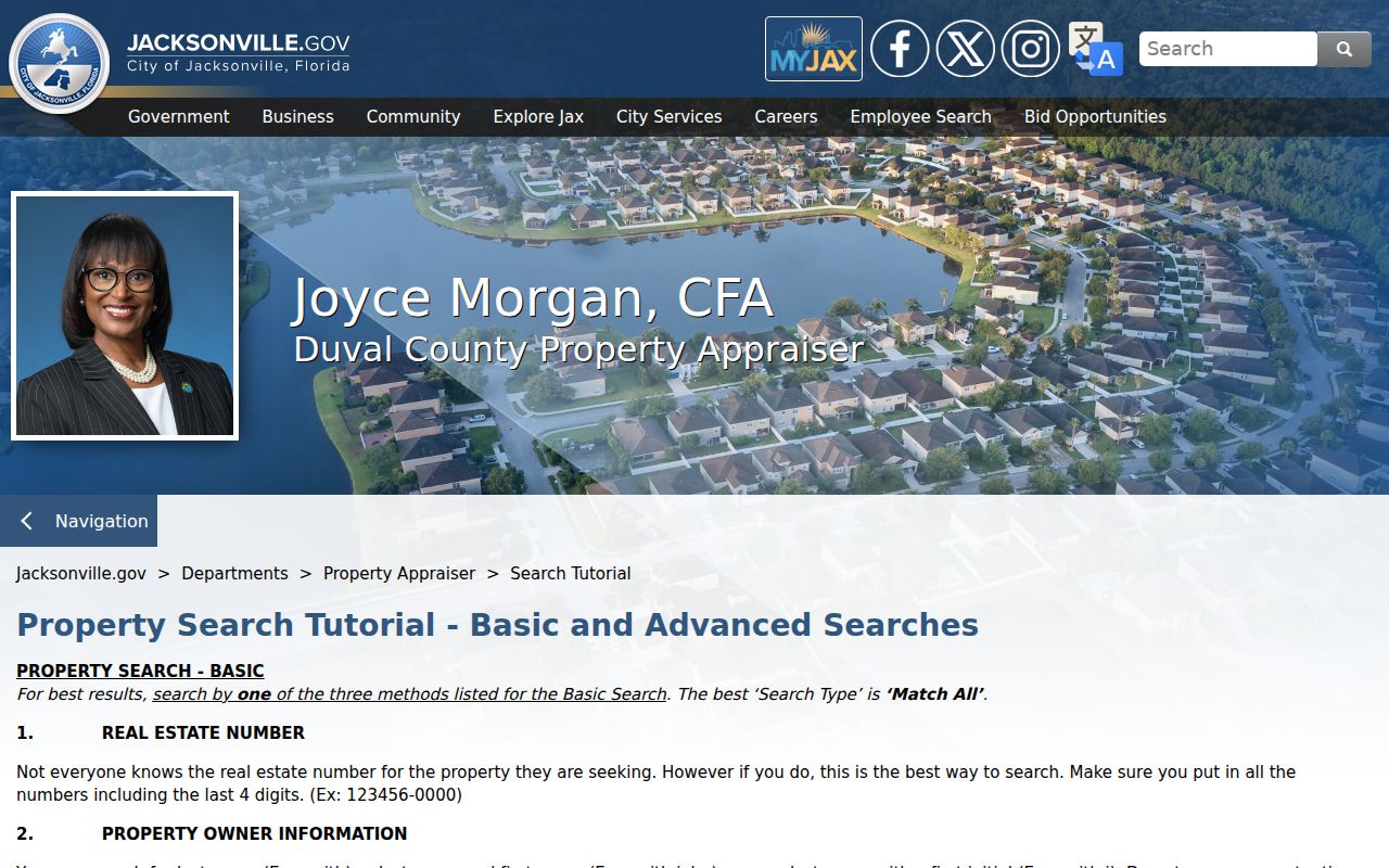
The tutorial supports careful by-address work when a full postal form produces no result. The live basic search form is the direct starting point.
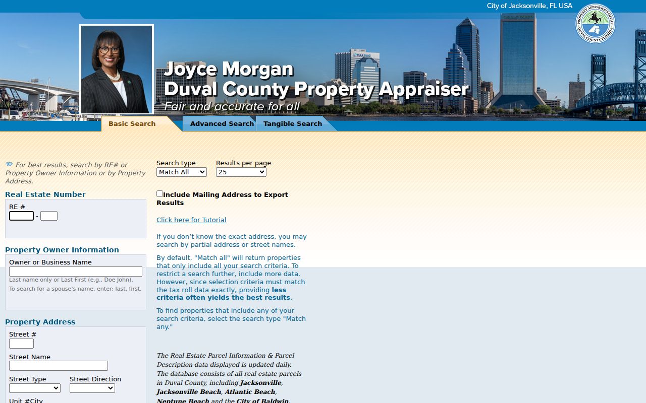
Separate fields let a searcher remove uncertain parts one at a time rather than guess at a fixed address string.
Read Duval County Parcel Cards
A result card distinguishes the Primary Site Address from the owner’s mailing address. The first places the parcel. The second is where tax notices go, and it may point to another city or state. The card also shows the RE number, tax district, legal description, subdivision, building data, values, exemptions, sales, Official Records book and page, and map links. Working-roll values marked “In Progress” can change.
A representative Duval parcel detail shows those fields together.
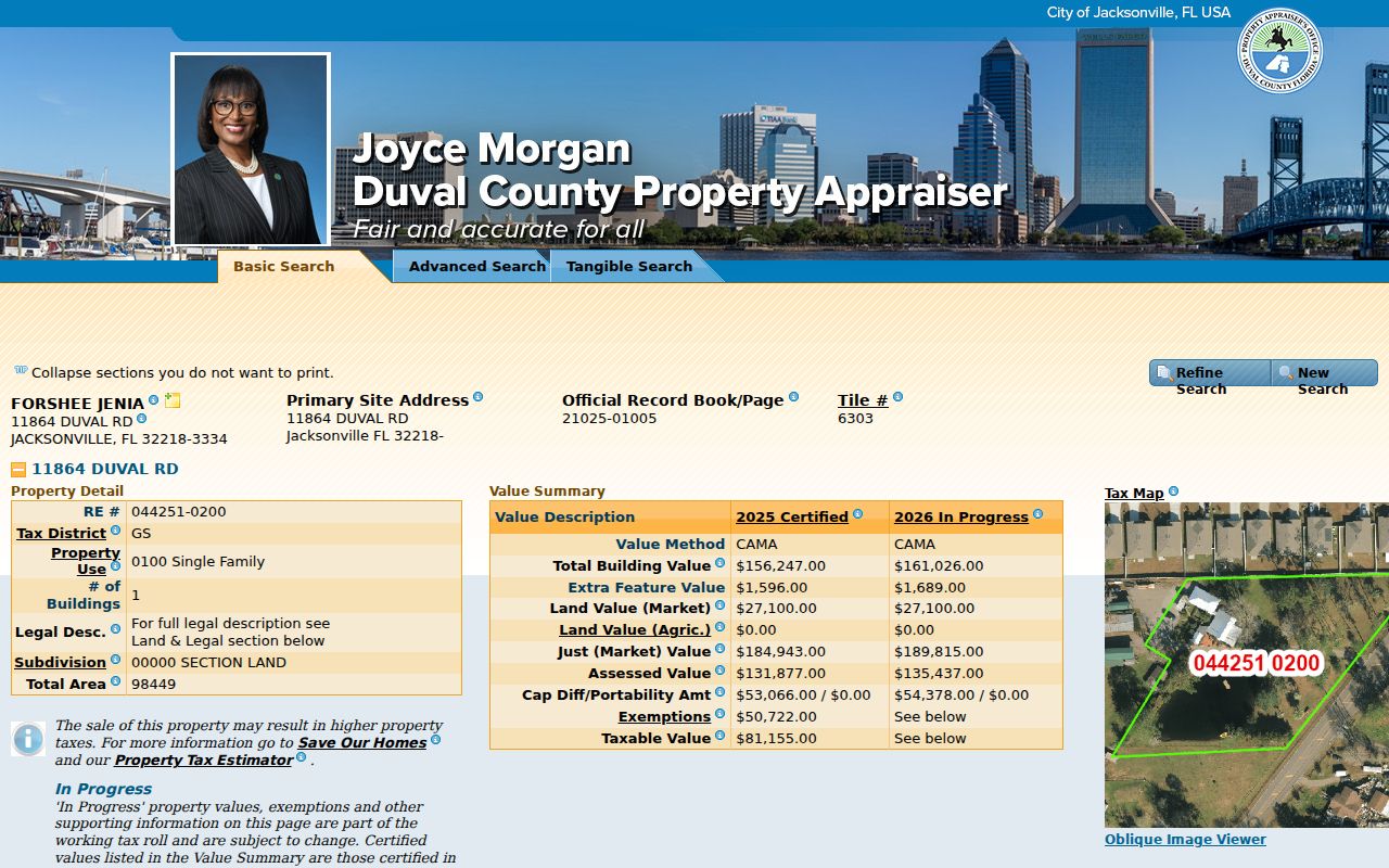
The visible mailing and situs split prevents a common street-directory error: placing an absentee owner inside the property because the tax roll names that person.
- Parcel
- A legally identified piece of land on the property roll.
- Situs address
- The parcel’s physical address, distinct from an owner mailing address.
- Plat
- A recorded map of lots, blocks, streets, and easements.
- Criss-cross directory
- A directory arranged by street and house number, not surname.
Homestead exemption can support an owner-occupancy inference. It never names every person in the home.
Map Duval County Streets
The Jacksonville GIS gateway leads to several public mapping applications. For parcel work, choose the Duval Property map. Zoom until boundaries appear, select a polygon, record its RE number, and open the property detail. Then pan along the road and repeat. Imagery, zoning, flood, district, and planning layers can explain geography where available, but a layer describes land, not occupants.
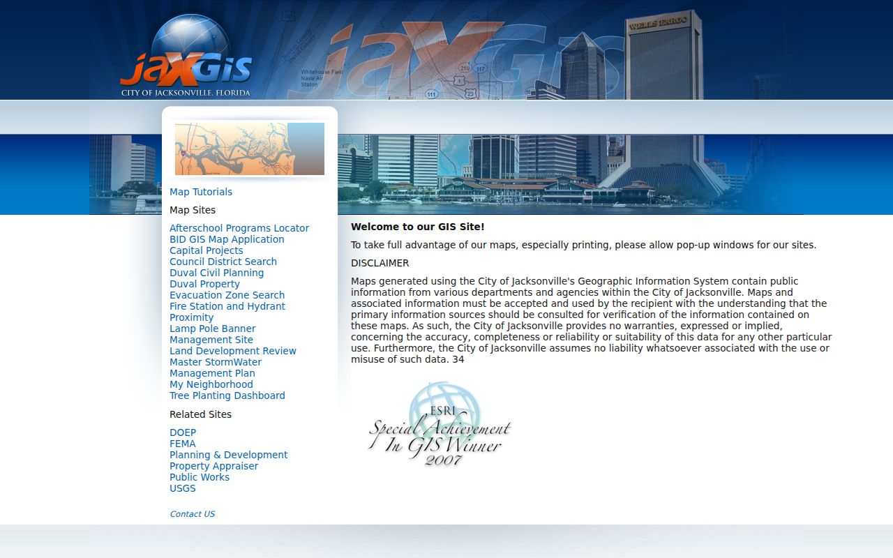
The gateway helps users choose the correct map instead of treating every geographic layer as one source.
The Duval Property map offers Parcel, Address, Street, and EDA search modes. Results can export to Excel or open in Details and My Neighborhood. Broad results stop at 1,000, so narrow the road or area.
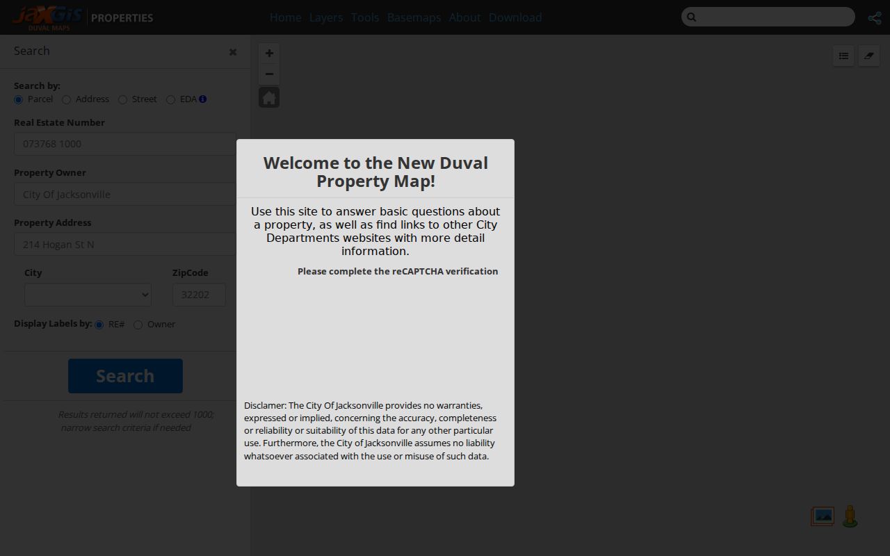
The Query Tool targets parcels, streets, or address points. Select By/Buffer draws a distance around a point, line, or polygon. These tools locate adjacent land; parcel cards supply ownership fields.
Note: Only the Topographic basemap is described as maintained with approved Jacksonville GIS changes, so verify other layers with their source departments.
Duval County Street Record Layers
No single Duval County record supplies a complete street directory. Each source answers a narrower question and has a fallback when its web interface is incomplete.
| Address source | What it adds | Access | Does not prove |
|---|---|---|---|
| Property roll | Owner, situs, mailing, RE number, legal description | Portal, map, office | Renters or household |
| Parcel GIS | Boundaries and public layers | Free map | Occupancy |
| Official Records | Deeds, liens, plats, parties | Acclaim since 1988; request earlier | Residence after sale |
| Permits/code | Work, dates, responsible parties | Portal or request | Contractor residence |
| Voter records | Public registration fields | Verification or request | All residents or votes |
| Reverse directories | Listed occupant by number | JPL and databases | Complete household |
Jacksonville’s 1968 consolidation adds a custodian check. Jacksonville Beach, Atlantic Beach, Neptune Beach, and Baldwin retained municipal governments. Verify jurisdiction in GIS before asking for a permit or code file merely because the postal address says Jacksonville.
Connect Duval Streets to Deeds
The Clerk records deeds, mortgages, judgments, liens, satisfactions, plats, and other Official Records. Acclaim searches by people, instrument data, date, document type, consideration, book and page, or case number. It is not a street list. Begin with the parcel card’s owner and book/page, then match the deed’s legal description before adding the transfer to a street record.
The Clerk’s Recording Department overview explains the recording role.
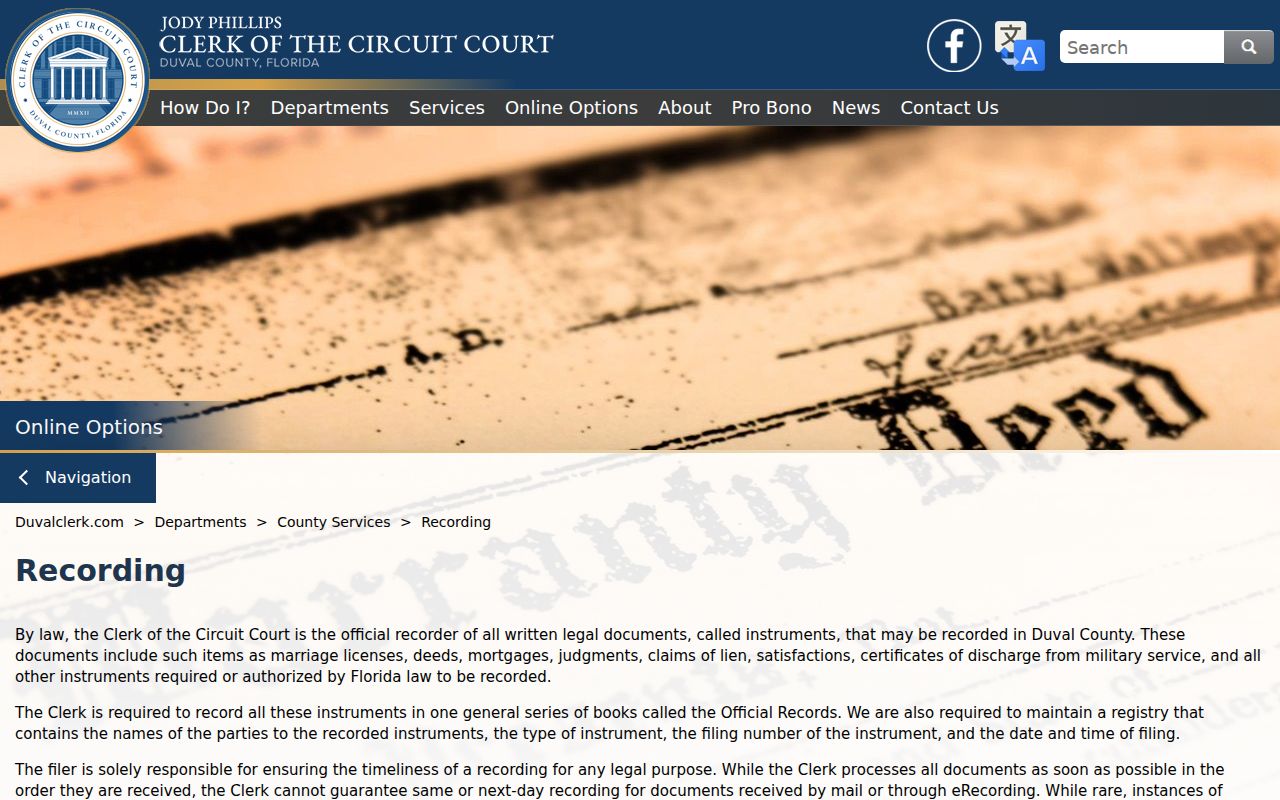
A recorded instrument proves that a document entered Official Records. It does not certify that each party lived at the property.
Acclaim covers online records from 1988 and marriage licenses from February 1981. Earlier deeds require staff help at Official Records, Room 1253, Duval County Courthouse, 501 W. Adams Street, Jacksonville. Public hours are weekdays, 8 a.m. to 5 p.m.; call 904-255-2025. Mail requests use that address and should include a self-addressed stamped envelope.
Filter the Duval County Roll
The Property Appraiser’s advanced criteria can turn a long named street into a more useful working set. Available filters include sale-date and sale-price ranges, qualified or unqualified sales, vacant or improved status at sale, value and heated-area ranges, subdivision, five-digit ZIP, map tile, property use, land use, extra features, year built, and homestead status. Multiple ZIP values are entered with commas and no spaces. These controls describe parcels, not people, but they can separate a subdivision, building era, or property type before each result is checked.
Exports can include mailing addresses when “INCLUDE MAILING ADDRESS TO EXPORT RESULTS” is selected. Keep that column apart from the property location. It is often the best official lead to a nonresident owner, yet it does not establish where anyone currently lives. Online results show RE number, owner, and location, while a full parcel card supplies the legal and sales context needed for a careful street directory entry.
The map adds another route when text search is too broad. Its Street mode, parcel labels, and Excel export can help inventory a road, while the Query Tool supports operators such as LIKE and NOT LIKE. Results are capped at 1,000. Narrow the area instead of treating a truncated export as a complete street.
A Duval County Index Quirk
Acclaim warns that instrument numbers from January 1 through January 20, 2004 originally carried an extra zero that was later removed. If an expected number fails, retry by party or book and page. The portal also recommends all spelling variations. A blank result is not proof that no record exists. Search fields, date coverage, indexing, and protected web images all shape what appears.
Duval County Permits by Street
Building and code records add events to an address. A permit may show number, property or RE number, site address, owner, applicant, contractor, work type, value, status, issue and final dates, and inspections. Code material may show a cited owner, site, violation, hearing, and outcome. Those names show responsibility for a filing, not who lived there.
When online search fails, use the City public-records center, department custodian, or 630-CITY at 904-630-2489. Ask for existing records by address, type, and date span. Florida Public Records Law does not ordinarily require a purpose, identity, or written request. Ask for an estimate if retrieval or redaction may be extensive.
Older Duval County Street Clues
Historic address work should follow the land as well as the number. Jacksonville’s Great Fire of 1901 destroyed much of downtown and broke building, business, and address evidence. Consolidation in 1968 changed the scope and custodian of local records. Postal geography adds another mismatch because a Jacksonville mailing label does not settle jurisdiction.
Use the legal description, lot and block, plat, and Sanborn sheet to bridge breaks. Jacksonville Public Library’s Digital Sanborn Maps cover insurance mapping generally from 1867 through 1970 and can show footprints, construction, use, and number changes. They do not identify occupants. The Duval County city directory route covers publisher-listed names and reverse editions in depth.
Duval Voters Are Not Streets
The Florida voter-status form verifies one voter using first name, last name, and birth date. It does not browse everyone on a road. A tailored request to the Supervisor of Elections can seek lawful registration fields by geography, but exempt data must be removed. Social Security and driver-license or state-ID numbers, registration source, protected addresses, and preregistered minor data are limited.
The state also prepares a monthly voter extract from all 67 counties. It includes active and inactive voters as of the prior month’s end, but omits confidential, exempt, Address Confidentiality Program, and preregistered-voter information. It is supplied on disk by mail or pickup rather than as an instant download. A focused request should identify the geography and fields needed. Duval-specific requests can go to the Supervisor of Elections at SOEPRR@coj.net or 904-255-VOTE.
Absence proves little. Children, noncitizens, unregistered residents, removed voters, and protected voters will not form a complete household list. Voting history shows participation, never ballot choices.
Limits of Duval Street Records
An owner can live elsewhere. Homestead supports owner occupancy but cannot identify each household member. Renters and minors may leave no address-searchable public trace. Utility accounts and motor-vehicle addresses are not public household directories, and protected residents may have addresses withheld. A reverse directory reflects its publisher’s survey, not an official census.
Use a street directory to study property, verify an address, follow a deed, or support family and neighborhood history. Keep “owner,” “registered voter,” and “directory occupant” as separate labels.
Lawful use. Duval County address records are for lawful personal research. Never use them to stalk, harass, intimidate, or harm a person.